High Precision Fiber Optic Gyroscope Inclinometer
Summary
The instrument is a new type inclination measuring instrument which adopts a high precision fiber optic gyroscope. It can be used to determine dip angle and azimuth angle of vertical borehole or direction borehole in magnetic field or iron casing tube. It can also determine the depth of borehole accurately. It has been widely used in engineering, hydrology, oil field, coal field, and geology for borehole determination.
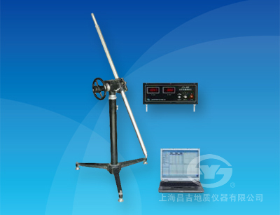
The instrument is made of the ground control box, inclinometer probe, and laptop computers, designed to be portable; equipped with special software to display and print the borehole inclinometer data tables, drawing drilling plan, section, side projection and spatial trajectories.
I. Main technical features
1. The instrument uses a high-precision FOG azimuth measuring device, small size, long life, shock and vibration, small
zero drift. It is the most ideal directional sensor for measuring the azimuth angle in the magnetic mine area and the iron
casing, that is, the shortcoming of the power tuning gyroscope is avoided and the advantage of the power tuned
gyroscope is improved.
2. The instrument uses a high-precision dual-axis tilt sensor as an angle measuring device, after 24 AD samples
obtained after data processing vertex data.
3. Application-optimized digital signal processing to optimize the measurement system to accurately measure the angle
and azimuth, the measurement results to achieve high precision requirements; Dynamic Compensation technology to
eliminate gyroscope zero drift, zero drift precision measurements.
4. Application of the technology of long wire transmission in digital communication, reliable transmission of long cable
digital signal, and improve the anti-interference ability of the instrument.
5. Do not need to ground directional, you can always measure the true north azimuth drilling, saving time and effort, to
ensure the accuracy of measurement.
6. The ground control box angle, azimuth, tool face angle and signal transmitted to the computer after mixing depth.
7. Computer ground data processing, display, save and draw a plane projection, can print three-dimensional trajectory
map.
II. Main technical specifications
1. Measuring range:Angle: 0 ° ~ 50 °,Azimuth: 0 ° ~ 360 °
2. Measurement accuracy:
Angle measurement error: ± 0.2 °,Azimuth measurement error: < ±3°(angle 1 ° ~ 50 °)
3. Measuring depth: 1500 m (temperature <60 ℃)
4. Measurement: measuring point
5. Working power supply: AC 220V±10%;50HZ
6. Power consumption: about 75W
7. Environmental temperature: -10 ℃ ~ 55 ℃
8. Instrument cable: four-core cable (resistance <85Ω / 100m)
9. Dimensions and weight:
Downhole probe: Φ50 mm×1680 mm / 9kg,Ground control box: 370 mm×160 mm×290 mm / 6kg
NOTE: Notebooks, winches, cables should be reprovisioned.